About This Project: The Permian Basin Programmatic Agreement

The Permian Basin Programmatic Agreement is a bureaucratic name for a bureaucratic process whose end result is new information about the prehistory and history of southeastern New Mexico.
The agreement is among the Bureau of Land management (BLM), Carlsbad Field Office (CFO), that manages archeological sites located on BLM land within the field office; the New Mexico State Historic Preservation Officer (SHPO), who is charged with the preservation of archeological and historical sites in New Mexico; and the Advisory Council on Historic Preservation, that advises federal agencies about their compliance with federal preservation laws and regulations. Also participating as consulting parties are the Mescalero Apache Tribe, whose traditional homeland includes southeastern New Mexico; the New Mexico Archaeological Council, composed of professional and avocational archeologists interested in the archeology of New Mexico; the New Mexico Oil and Gas Association and the Independent Petroleum Association of New Mexico, both organizations representing oil and gas companies whose goal is to produce oil and gas minerals from BLM land in southeastern New Mexico. The agreement that was reached among these parties is that within a certain portion of the CFO oil and gas projects on BLM land may be completed without doing a new archeological survey, provided the projects avoid recorded sites, and that a contribution equal to the cost of the new archeological survey is made into a fund dedicated to archeological and historical research.
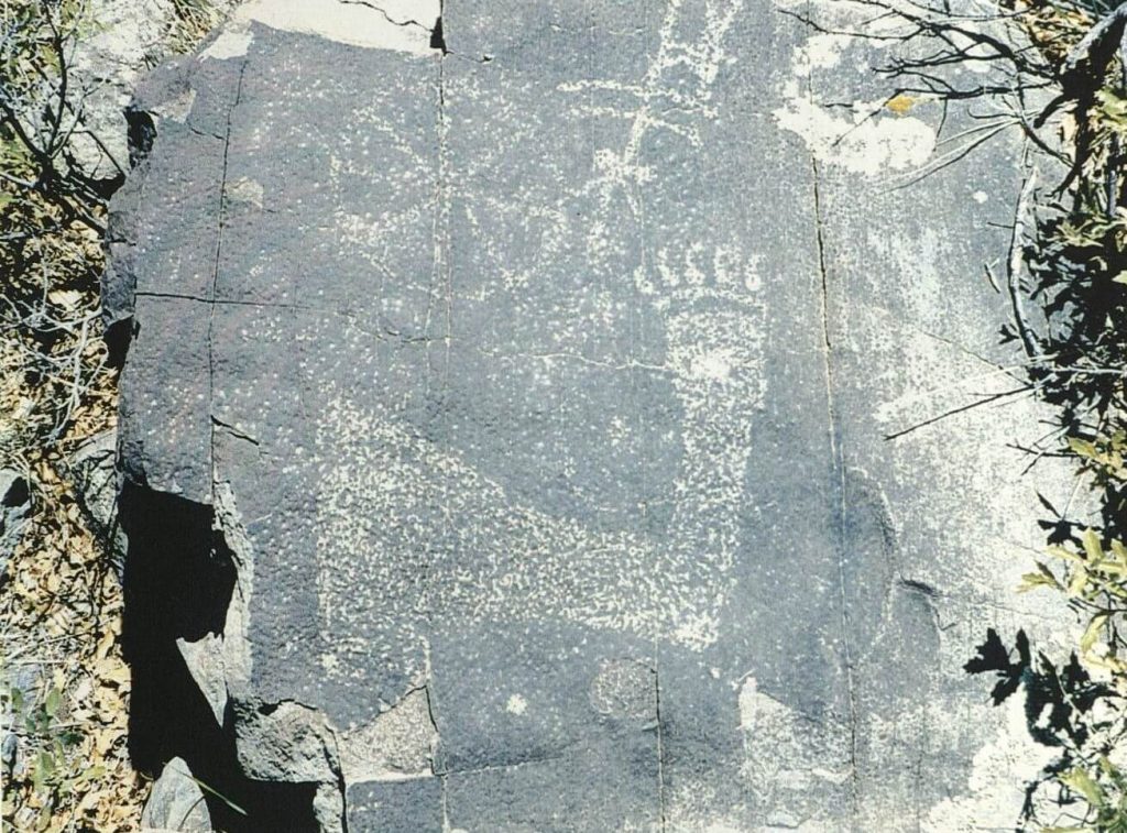
Guided by two consecutive research designs and with advice from an advisory Workgroup, 23 major projects have been undertaken in all parts of the CFO. One example is an archeological survey to record sites within seven large study areas in the foothills of the Guadalupe and Sacramento mountains in Eddy and Chaves counties. Altogether 635 new and previously recorded sites were documented. All site types were recorded, but most are doughnut-shaped heaps of burned rocks, called ring-middens, that are evidence of multiple episodes of roasting plants, primarily agave. Several thousand years of this subsistence activity are recorded in these sites and future investigations of this topic will provide interesting insights into this aspect of prehistoric life. Farther east on the Mescalero Plain, 29 sites from the later prehistoric period have been located and the examination of these sites will shed light on the transition to village life that occurred during the period circa A.D. 1100 to 1400. Another example is building upon the recording and preliminary interpretation of 21 rock art sites located on BLM land, by including an additional 74 rock art sites in the Guadalupe Mountains, that will be recorded and interpreted. Rock art is defined as petroglyphs, that were incised, pecked, or abraded into exposed bedrock or rock eroded from it, and pictographs that were painted on the rock’s surface. Recorded petroglyphs and pictographs in the Guadalupe Mountains include human and animal figures and various geometric designs. Collectively these sites record information about the people and societies who created them that is not available through other traditional forms of archeological studies, such as artifact classifications or stratigraphic analyses. Other projects large and small have benefitted from Permian Basin Programmatic Agreement funding.
A major goal of the Permian Basin Programmatic Agreement is to share information about the archeology and history of southeast New Mexico with the public. This website is one avenue we can take to make this happen. Expect to see the results of the studies mentioned above, plus many others featured here in the future.
