Regions

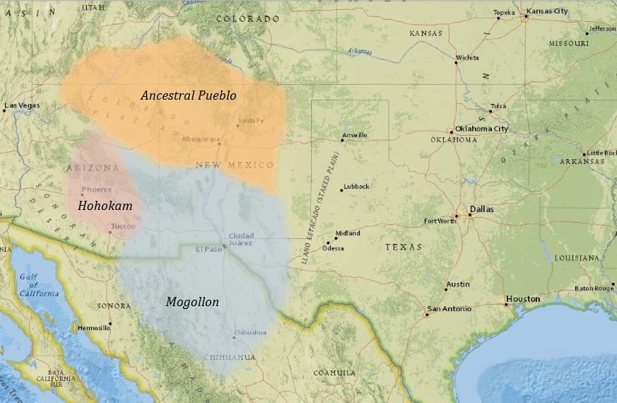
The ancestral Southwest comprises many culture groups including the Ancestral Pueblo in northern New Mexico, the Hohokam in Arizona, and the Mogollon in southern New Mexico, Arizona, and Mexico. These regions are defined by the people who inhabited them, who created similar but unique cultural practices. Differences in pottery style and design, rock art depictions, house style, and even subsistence strategies help modern archaeologists understand the many ethnic groups that made up the Southwest thousands of years ago. The divisions shown on a map can be misleading, though. Much like modern day peoples and places, communities in the past did not adhere to arbitrary lines on a map. Trade, mobility, and migration were common in the Southwest and undoubtedly resulted in culture sharing between groups. On Map 1, you’ll see that the dividing lines between Ancestral Pueblo, Hohokam, and Mogollon are literally blurred to represent the figurative blurring that occurred between groups.

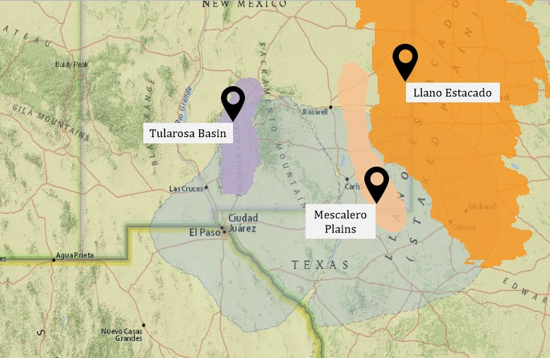
The greater Mogollon tradition can be divided into six distinct regions (Mimbres, Black River, San Simon, Jornada, Pine Lawn, and Forestdale), which we can think about as distinct populations that are each connected by their shared, broader culture. Of these regions, Mimbres is well-known for its potters who produced striking black-on-white pottery with unique geometric and anthropomorphic designs. In Map 2, you’ll see the Mimbres region in relation to Jornada Mogollon. The Jornada Mogollon, and its eastern extension, is also highlighted because many archaeological sites that you will explore on this website are located in this region.
As you explore Map 3, you will also see several geographic areas highlighted. These include the Tularosa Basin, the Llano Estacado, and the Mescalero Plains.
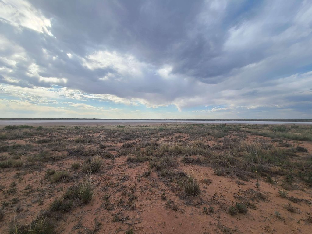
The Llano Estacado, a region spanning northern Texas and parts of southeast New Mexico, is one of the latest mesas in North America. Once known as the “Great American Desert”, this region is actually part of the Great Plains.

The Tularosa Basin lies between the San Andres and Sacramento mountains, and is roughly 150 miles north-south and 60 miles east-west. Today the Tularosa Basin is home to White Sands National Park. White Sands NP encompasses 275 miles of white gypsum sand dunes as well as many archaeological sites. Ancestors settled in White Sands long before the sand dunes formed, when most of the basin was a large lake. Paleoindian peoples likely thrived in this environment, using the lake for many necessary resources. From the paleoindian through the formative period and beyond, populations of ancestral peoples moved through and around the Tularosa Basin. Today the Mescalero Apache Indian Reservation is established in the basin, the Apache ancestral homelands.
The Mescalero Plains lies between the Llano Estacado and the Pecos River, and nearly runs into the Guadalupe Mountains to the south. As we see on the map, the plains region also pierces the Jornada Mogollon eastern extension down the middle. Throughout the formative period, ancestral nomads in southeast New Mexico were drawn to the Mescalero Plains, likely for its abundance of water sources. Today, this area is dotted with hunting camps and ephemeral sites, suggesting that nomadic hunters and gatherers preferred the plains throughout prehistory.

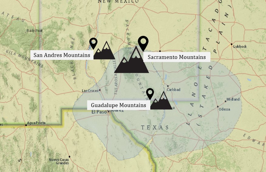
Next, Map 4 reveals important mountainous regions including the Sacramento Mountains, the Guadalupe Mountains, and the San Andres Mountains. Each of these places represents an important piece of the ancestral puzzle. However, the Guadalupe Mountains play an especially significant role in the history of southeastern New Mexico. Many of the archaeological sites that you can explore on this site are rock art sites, and they are all located in the Guadalupe Mountains. This mountain range was likely special to the ancestral peoples who once inhabited the land, as they left their stories and histories painted and pecked on its walls.
Today, the Sacramento Mountain range is home to the Sierra Blanca peak, a sacred peak to Apache peoples. The sacredness of this place to tribes today suggests that it was equally as sacred to their ancestors.
When you view all of these maps together, you may begin to understand the physical and cultural regions as a whole. For instance, the maps illustrate that the eastern extension of the Jornada Mogollon region overlaps the Mescalero Plains. As you explore the sites on this website, you’ll notice that many are located on the Mescalero Plains. You might also observe the Jornada Mogollon region in relation to important natural features such as the Guadalupe Mountains or the Pecos River. Sacred mountains and life-giving water sources were and are vital to indigenous lifeways. Noting their proximity to ancestral settlements can help us think about the bigger picture.

How did ancestral peoples move across the landscape? Click here to explore migration patterns through time.
